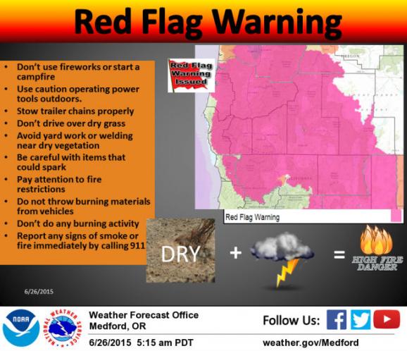
ATTENTION: Red Flag Warning Issued for Southern Oregon

THE NATIONAL WEATHER SERVICE IN MEDFORD HAS ISSUED A RED FLAG WARNING, WHICH IS IN EFFECT FROM 5:00 PM FRIDAY TO 11:00 AM SATURDAY.
Due to a combination of possible abundant lightning and dry fuels, a red flag warning has been issued for much of our forecast area in northern California and southern Oregon starting Friday evening. There is potential for rapid fire growth in these areas. Thunderstorm activity on dry fuels could result in new fire starts. New fires that develop will likely spread rapidly due to dry fuels and possible gusty winds. For more information, go to www.wrh.noaa.gov/FXC/wxstory.php?wfo=mfr.
Go to the following sites for more information:
Definition (NPS): Fire Weather Watch & Red Flag Warnings
Hazard Data Viewer: www.wrh.noaa.gov/map
Fire Weather Zone Forecasts: www.wrh.noaa.gov/firewx/?wfo=mfr
Safety/Preparation Information: www.ready.gov/wildfires
IMPACTS:
Increasing thunderstorm activity on dry fuels will result in new fire starts.
AFFECTED AREA:
In Southwest Oregon. Fire Weather Zone 615.
TIMING:
Isolated to scattered thunderstorms developing to the southeast late Friday afternoon are expected to develop further and move northwestward into the area late Friday evening through Saturday morning.
RAINFALL AMOUNTS:
These thunderstorms are expected to be dry... producing little or no rainfall.
COUNTIES AFFECTED:
Coos and Curry Counties in Oregon.
PRECAUTIONARY/PREPAREDNESS ACTIONS:
Abundant lightning on existing very dry fuels could cause numerous new fire ignitions. Gusty and erratic outflow winds could also create explosive fire growth potential.
